Full Length Research Paper

ABSTRACT
U Minh Thuong National Park is one of the two significant areas of peatland swamp forest remaining in Vietnam, and is recognized as one of the three highest priority sites for wetland conservation in Mekong Delta. A large area of Melaleuca Forest in the park was destroyed and degraded by a devastating fire in 2002. Besides this, an artificial flooding technique for controlling fire applied all over the park for several years changed the natural development of Melaleuca Forest. As the natural condition of the forest has changed, water management (artificial flooding) needs to be implemented to save this situation. Flooding regime has changed the structure and composition of the peatland, making it to be loose and reduced in structure. The peatland area in the park has water level of 30 cm underground and occupies 15% of the total park area. It emits very large amount of CO2 emissions. The main objective of this work is to study how to protect the forest biodiversity from fire by controlling its water level optimally after rainy season and to study the chemical and physical characteristics of the peatland soil of the forest that affect its water level
Key words: Melaleuca Forest, peatland, flooding,
INTRODUCTION
Peatlands are widely distributed in Indonesia, Malaysia and many other countries in Southeast Asia (Hooijer et al., 2010). Forests on peatland are suitable habitats for plants and animals, including many endemic species (UMTNP, 2004). They play an important role in ecological balance, especially in regulating flow, microclimate, water quality and soil formation process. Peatland in Vietnam is mainly distributed in the Red River Delta, Mekong River Delta and Southeast. The statistics of peatland area and reserves are very different; they are approximately 35,000 ha, particularly in U Minh Ha National Park (Ca Mau Province) and U Minh Thuong (Kien Giang Province) (Le and Thai, 2009).
U Minh Thuong National Park (UMTNP) is recognized as one of the three priority sites for wetland conservation in Mekong Delta. The alum Melaleuca Forest ecosystem of UMTNP, Vietnam is the oldest forest on top of the peatland. This forest is mixed with many species of wood and big trees. It is about 3.000 ha. The forest is an important ecosystem, because it provides shelter and feeding place for many wildlife and rare species (Vuong et al., 2005).
The forest fire in 2002 destroyed and degraded many areas of Melaleuca Forest in UMTNP. This was quickly followed with a plan to reserve water to prevent forest fire for many years. This significantly changed the natural development of the forest. The change in the natural condition of the forest affected its trees which were collapsed, degraded, and died locally. Also the forest cover was reduced and vines and aquatic plants growth increased.
Due to the natural conditions of UMTNP, water management is considered as an essential way to prevent and fight fire in Melaleuca Forest. In order to determine the optimal level of submergence and the water demand for prevention of fire in Melaleuca Forest, fire is required. Apart from the prevention of fire, it is necessary to ensure forest growth, conservation of Melaleuca Forest ecosystem and biodiversity of UMTNP. The only focus of this study is to examine the effects of flood on the growth of Melaleuca trees, plant diversity and flood risk. There has been a little research on the effect of flood on peatland in UMTNP. Therefore, assessing the impact of flood regime on peatland is done to determine the optimal flood water level that can prevent forest fire and conserve Melaleuca Forest ecosystem.
This study aims to determine the volume of the peat after the forest fire in the park in 2003 and survey its water level per year, from 2002 to 2011 in order to propose a plan for preventing fire from the Park and conserving Melaleuca Forest in UMTNP.
METHODS
Inherited documents
These include previous research materials on forest vegetation, soil elevation map, and hydrological regime related to peatland in UMTNP.
Collection of peat samples
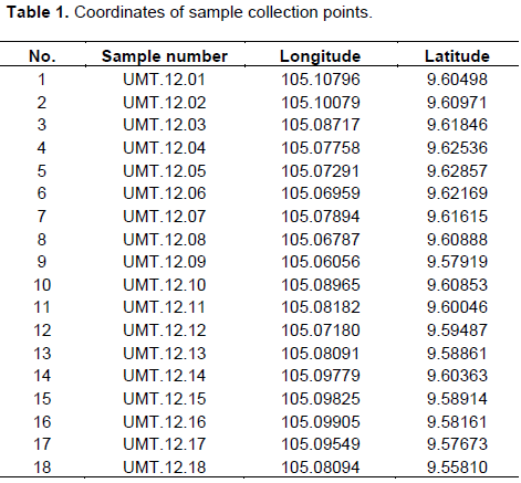
Based on the 2010 soil elevation map and the annual water level monitoring results, 18 samples of peat soil were collected at different peat levels. During the collection of the peat samples (May 2012) which is the beginning of the rainy season, it was difficult to excavate the soil profile, so we used manual drilling method, drilling through all the peat layers. Position of the sample collection points is shown in Table 1 and Figure 1.

From the 18 locations in UMTNP, 18 peat samples were taken from peat depth of 0.1m to 1.2m. The peat samples are evenly distributed over the entire area of the peatland in UMTNP. From peatland layers with 0.2- 0.8 m thickness, most areas in the core zone of UMTNP and the peatland layers remaining after the forest fire in 2002, 2 samples were collected from each level (the distance between each level is 0.1 m). The remaining layers of the peat are collected as sample 1 (Table 2).

Samples of peatland were analyzed in a laboratory at the Ecological Center, Vietnam Forest Science Institute. Sample analysis parameters include: density; pH H2O and pH KCl; composition of organic substances; and inorganic ingredients.
Calculation of peat reserves and carbon
From the results of the sample analysis, we calculated the peat reserves and carbon stocks according to the following formulas (Forest Inventory and Planning Sub Institute II, 2003):
Peat reserves (M)
M = h × Si ×Dd (UMTNP, 2004)
where
h (metere)= Thickness of peatland layer.
Si (square metere) =The area of peatland.
Dd (Ton = 1,000kg))= Weight of peat land.
Carbon reserves (Mc)
Mc = M × %C (UMTNP, 2004)
Where
M =Peatland reserves.
%C = Percentage of carbon in peatland.
Calculation of emissions from oxidation of peatland
Emissions obtained from oxidation of peatland are based on peatland area and characteristics of groundwater levels, applying the calculation formula used in Indonesia with a default coefficient of 91 tons/ha/year, at 1 m depth (Hooijer et al., 2010). However, due to the topographical characteristics of the hydrology in UMTNP, some areas of peatland are still inundated during the dry season. The areas are high, the water table is low for 6 months; so the coefficient of CO2 emission is 45.5 ton yearly per ha, at 1 m depth of peat. Therefore, the total emissions obtained from the oxidation of the peatland are calculated as follows:
CO2emission = LU Area× D Area× D Depth× CO2 - 1 (ton/year ) (UMTNP, 2004)
where
LUArea:(square metere) Area of peatland.
DArea: (square metere) the area of peatland is lowered to the groundwater level.
DDepth(metere) The average depth of submerged water in the peatland is lowered to the groundwater level.
CO2 - 1: CO2 emission at the average depth of groundwater level = 45.5 tons of CO2/ha/year.
Data of underground water levels are collected from groundwater monitoring data from 2002 – 2011.
RESULTS AND DISCUSSION
Current status of peatland
UMTNP originated from the alluvial sediments of Mekong River and further formed an alluvial plain, which is followed by the development of mangrove forest. In the development process, its organic matters were accumulated leading to the formation of the peatland (Nguyen et al, 2017). When the soil was not intruded with salt, Melaleuca forest was formed and organic matter of the Malaleuca continued to accumulate at the water level for a few thousand years. This resulted in the formation of the peat. If there are changes in the water level in the dry season, the peat will decompose into humus (Thai, 2019). The total area of the National Park is 8,038 ha while that of the core zone of UMTNP is 3,906.6 ha (peat thickness of 30 to 130 cm).
The depth of the peatland layer from 120 - 130 cm has an arear of 148 ha while that from 30 - 120 cm has an area of 3,758.6 ha. However, the depth of peatland layer from 70 - 120 cm is 1,427.9 ha. Other zone also has peatland but in smaller areas of 0.01 ha. The status of the peatland before the forest fire of 2002 is shown in Tables 2 and 3.
There are different elevations in UMTNP; 50% of the area of the peatland has 0.6 to 1.0 m depth. The depth of the areas over 1.4 m is only 20% of the total area of the peatland. The distribution of the surface elevation in UMTNP is uneven; the ground of the south is higher than that of the north of the park. The distribution of peatland with altitude is the basis for designing the plans of the water management to conserve the forest ecosystems and prevent Melaleuca Forest fire.
Peatland is formed by the decomposition of the organic matter that has not been completely accumulated for thousands of years without oxygen and with flood. From the drilling results of peatland samples in UMTNP, it is shown that above the peatland layer is the litter layer that has not been completely decomposed (10 - 50 cm thick). The litter layer is 30-50 cm thick in the remaining forest areas of peatland not burnt in 2002. The 10-15 cm thick layer of litter is in the regenerated forest areas of the peatland burnt in 2002. Below the peat layer is a gray to gray-brown clay layer, containing little plant residue, with thickness of 1-1.5 m (alum-bearing material layer).

UMTNP’s peatland is mainly distributed in areas with average ground elevation below 0.5m. In this area, the ground is low and the alum layer is thin. Most of the active acid sulfate soils are distributed in marsh zone or ancient tidal creeks.
The height of peatland layers varies and depends on the previous burnt conditions. With high frequency, the peat will be highly burnt; this will make the burnt peatland to be thin and the remaining peatland layer to be very thin. Currently, in UMTNP there exist mainly peat soils on potential alum peatland, and active alum peatland.
Peatland on alum peatland
Below the peatland layer is the alum layer that appears in different depths. In places where there is deep alum layer, acid sulphate soils are formed, whereas thin alum layer forms active alum soil. In places where there is a lot of alum soil, there is usually bright, clear water. In places where there is heavy iron, the soil and water become dark brown.
Peatland
Peatland layer
Morphologically, it can be divided into two types: the black peatland, which has high resolution at the bottom and the brown peatland, which has a friable structure. At the black peatland layer some points contain ramshackle wood.
The peatland remaining after the fire is mainly black and compact peatland. It is usually less than 1.3 m thick layer. This layer is under the peatland, with a higher density. The peatland is tight, so it has the ability to absorb water by capillary. The layer of the black peatland is usually moister than the brown; the black peatland layer is soft above it and is often harder and easier to burn. In very dry weather, locations far away from the water canals have low humidity to the extent that it can spark forest fire.
The acid sulphate soil formed on the sample of without peatland
The total area of UMTNP had thick peatland layer up to 3 m. The thickness of peatland is gradually lost after each forest fire. Depending on the drought conditions of each location, the peat layer can be highly burnt and with little difference levels. Most of the current inert clay areas are the result of intense burning of peatland layer. In this type of peatland, the alum layer acts near the ground (<50 cm).
Tables 3 and 4 show that the 2002 forest fire caused the peatland layer to burn completely, an area of 218.1 ha. The peatland area with 100 cm thickness is 647.7 ha. Currently, peatland layer with 100 cm thickness is 597.3 ha. This is the area with the thickest remaining peatland in the UMTNP.

Peatland sample analysis
Results of analysis of 18 peatland samples are listed in Table 3. Analysis of the 18 peat samples shows that pH is relatively high, from 4.8 to 5.2, and an average of 4.9. The organic matter content ranges from 73.8 to 89.6%, an average of 73.8%. High carbon content ranges from 38.34 to 50.47%, an average of 42.12%. Because the organism is not fully dissolved, the amount of humic acid in the soil is low (<20%). Peatland has a density of 0.23 - 0.26 g/cm3, an average of 0.24 g/cm3.
From the results of peatland sample analysis in Table 4, we calculate the weight of the peatland, 1.3m. The calculation results show that 1 ha of 1 m depth of peatland contains 940.32 tons of carbon (Table 6).
Based on the analysis of the physical and chemical parameters of the peatland, the amount of organic carbon in peatland in UMTNP along with percentage of carbon (C) in each peatland layer is shown in Table 5. The mud always varies; the lowest is 38.34% at a depth of 0.3m, the highest is 50.47% at a depth of 0.7m, and the average is 38.34%. Peatland in UMTNP has different thickness in each peatland layer, so there is a difference in carbon content at each point. Areas of the peatland with 70 cm thickness contained up to 844.31 tons/ha of carbon; whereas areas with 120 cm peatland layer thickness contained 1,115.59 tons/ha of carbon.


From the method presented, the peatland reserves, carbon as well as accumulated carbon are shown in Table 7. The results show that the total volume of peatland in UMTNP is 26,763,900 m3; peatland with 30 to 70 cm thickness has a maximum volume of 11,653,500 m3,and that with 120 to 130 cm thickness has the smallest volume of 1,850,000 m3. Based on the calculation results, the total volume of peat in the whole UMTNP is 6,373,913 tons. The area with 30 to 70 cm thickness has the largest volume of 2,796,840 tons, while the area of peatland with 120 to 130 cm thickness has the smallest volume of 444,000 tons. Carbon reserves in UMTNP are 2,682,211.2 tons.

Effect of submerged regime on peatland
Effect of flood regime on peatland structure
One of the factors that strongly influenced the existence of biodiversity in U Minh Thuong Melaleuca Forest is the relatively thick peatland layer. The peatland layer provides nutrients and a stable substrate for the development of Melaleuca populations; it is home to many land and aquatic animals. It also creates high and suitable places of residence for many species of birds, animals including wild animals. The peatland layer also has the ability to retain water and prevent alum and saline invasion, creating a favorable environment for the existence of many species in the Melaleuca Forest ecosystem.
However, the peatland layer is also strongly influenced by other components. Peatland will decompose quickly due to oxidation when the water level is lowered for a long time or when there are rainwater flows with dissolved oxygen absorbed and strong movement horizontally, increasing the process. CO2 emissions are observed. It will also be softened and flabby when over-watered, or quickly lost if there is repeated forest fire many times with short cycles.
According to Thai and Nguyen (2004), the forest water level on peatland in Pekan Region of Malaysia is very little below 20-30cm and this is also the hydrological condition of most tropical peatland forest areas. It ensures anaerobic conditions to slow the rate of oxidation and decomposition of peatland than their formation rate; the peatland layer will stabilize and rise. Research results also show that in natural conditions, the lowest water level always changes, depending on the weather characteristics each year. But, the probability of the water level below the peatland surface is more than 50 cm,which implies that the probability of occurrence of forest fire risk is very low, and only occurs in few years when there is rare rain and very dry weather. Therefore, to protect peatland layer as a factor to maintaining forest biodiversity of Melaleuca Forest, it is necessary to regulate the water level which is 30cm below the peatland surface and should not be more than 2-3 months per year.
Effect of submerged regime on peatland composition
According to the results of water level monitoring in UMTNP from 2002 to 2011, the whole area of peatland in UMTNP was flooded from 2003 to 2009, and after changing the water management plan, the average water level in the dry season was 30 cm below the peatland layer in high peatland areas. The results of the average peatland area of 30 cm below peatland layer are about 586 ha, accounting for 15% of peatland area (Thai, Tran, 2013).
Due to the subdivision water management regime, these peatland areas are only partially dehydrated during the dry season. The amount of CO2 emitted by peatland oxidation is 23,996.7 tons/year, accounting for 0.37% of the total peatland reserves.
However, the calculation of CO2 emissions with the characteristics of peatland layer in UMTNP needs to be done to collect data for a period of 1 year by comparing the analysed results of peatland samples, or using modern equipment to measure CO2 emission.
Designing water management plan to ensure forest fire prevention and the existence of peatland layer
The requirement for water management in UMTNP: Water management helps to ensure the growth of Melaleuca trees, conservation of biodiversity, protection of peatland frequency and importantly prevention of forest fire in Melaleuca Forest.
Water management for the growth of Melaleuca trees: The research results of many authors show that Melaleuca trees are tolerant species, not submerged species. They have a well-developed biogas system so they are able to withstand flooding for a certain period of time and at a certain depth. However, when the water is deeply submerged for a long time, their main roots gradually die due to anaerobic, unreliable pneumatophores in the ground that develops poorly. They become weak, and cannot absorb nutrients from the soil to maintain their growth and protect the trees from falling when the wind is strong. Gradually, the Melaleuca tree becomes yellowish and gets broken.
The natural flood tolerance of Melaleuca trees usually ranges from 6-7 months. If they are overgrown this time, the roots in the ground are often killed by anaerobic conditions and the water level inundated by Melaleuca is 40-60 cm. If they are deeper than the pneumatophores, they cannot access the soil to absorb nutrients and maintain their trunk. Therefore, to manage water for the growth of Melaleuca Forests, the flood water level must not exceed 40-60cm and the flooding time should not be more than 6 months.
Water management for biodiversity conservation: Maintaining biodiversity is the most important factor for conservation of Melaleuca Forest biodiversity. There are three major habitat groups of Melaleuca Forest, 1)dry area all year-round to shallow habitats for bird and animal species;2) seasonally inundated habitats for maintaining the dominant existence of Melaleuca species that are characteristic of alum forest trees, and 3)the year-round wetlands for the conservation and development of fish and aquatic species.
Therefore, water management should be taken seriously to conserve biodiversity and ensure the maintenance of dry areas all year round; all semi-submerged areas and all other areas should always be watered all year. These habitats are the premise to ensuring the existence of food chains and nets, the cycle of material circulation and the necessary energy of Melaleuca Forest.
Water management for fire prevention in Melaleuca Forests: Melaleuca Forests have a large amount of fire materialS including the leaves and dry carpet dozens of tons per hectare, and thick peat layer. In dry season, when there is dehydration, they can become dangerous fire materials that easily catch fire and become big fires. However, they are only really flammable when the water table is deep. When the underground water level is shallow, the water will soak up and moisten the peat, and the dry leaves will fall, preventing forest fire not to occur. The research results of the project KC.08.24 on how to prevent forest fire in U Minh and Central Highlands show that when the water level is not lower than 50cm under the peat surface, the material will be under the forest and the average humidity is over 20%; thus, forest fires cannot happen and if they happen, they can be extinguished easily. Therefore, the demand for water management for the prevention of Melaleuca Forest fire is to maintain the water level not lower than 50cm under the peat surface. According to the research results of the KC.08.24 project, the total amount of evaporation and leakage in the five months of dry season after deducting the rainfall in U Minh Thuong is 318mm. This is also the minimum amount of water that needs to be retained at the end of the dry season to moisturize and prevent fire in U Minh Thuong Melaleuca Forest.
Water management for the existence of peatland layer: The peatland layer plays an important role in the Melaleuca Forest ecosystem. To ensure the existence of peatland layer as a factor for maintaining the biodiversity of Melaleuca Forests, the water level is to be regulated below 30cm. If it is below peatland surface, it will not last more than 2-3 months per year and will not be completely flooded for a long time.
Thus, for water management to prevent and fight forest fire, the growth of Melaleuca trees, biodiversity conservation and the existence of peatland layer need to be ensured. It is necessary to develop water management plan in UMTNP and divide the elevations of different areas. These areas have relatively homogeneous terrain, reducing the area of ​​deep flooded areas and drought in the dry season. These zones are kept at different water levels at the end of rainy season based on the calculation of water balance. It leads to a reduction of drought peatland area of 127 ha; this accounts for 3.2% of the peatland area, ehich is equivalent to reducing 18,796.05 tons of CO2 emissions.
CONCLUSION
The total area of ​​peat land in the park studied is now 3,906.6 ha, with a thickness of 30 cm to 120 cm; it is unevenly distributed according to the ground height of the National Park. Peatland in UMTNP has a relatively high pH as well as high organic matter content. This is the area with the largest volume of peatland preserved in the Mekong Delta. The submerged regime has changed the structure and composition of the peatland, making it be loose and reduced. The average area of ​​the peatland underground water is 30cm, accounting for 15% of the total area, and a very large amount of CO2 emissions. Water management ensures that the goal of forest fire prevention, biodiversity conservation and the existence of peatland layers are met; so water in many areas with different water levels needs to be stored at the end of the rainy season. 78.3% reduction in CO2 emissions is equivalent to 18,796.05 tons/year.
CONFLICT OF INTERESTS
The author has not declared any conflict of interests.
ACKNOWLEDGEMENT
The authors would like to thank the Management Board, Director and technical staff (Dr. Thang) of U Minh Thuong National Park for their support in this study.
REFERENCES
|
DoNRE of Kien Giang (2009). Mineral geological report and mineral exploitation status in Kien Giang province. |
|
|
Forest Inventory and Planning Sub-institute II, (2003). Study on natural regeneration of Melaleuca Forest and propose forest rehabilitation |
|
|
Hooijer A, Page S, Canadell JG, Silvius M, Kwadijk J, Wösten H,Jauhiainen J (2010).Current and future CO2 emission from drained peatlands in Southeast Asia. Biogeosciences 7(5):1505-1514, |
|
|
IPCC (2006).Guidelines for National Greenhouse Gas Inventories 2006. Annex 2. Chapter 4. Methodological choice and Identification of key catelogies. |
|
|
Le PQ, Thai TL (2009). Report of peat soil survey results in U Minh Ha area. Ca Mau province 2009. |
|
|
Nguyen TP, Thai TL, Kevin EP (2017). Existing strategies for nanaging mangrove dominated muddy coats: Knowledge gaps and recommendations. Ocean & Coastal Management. Journal homepage: |
|
|
Thai TL, Tran TT (2013). Peatland Management in U Minh Thuong after Forest Fire 2003. Journal of Agriculture and Rural Development, 2012. |
|
|
Thai TL (2019). Aquaculture Operation in Allocated Mangrove Areas in KienGiang, Vietnam: Local perceptions and Recommendations. Journal of Coastal Zone Management. June 2019. |
|
|
Thai TL, Nguyen VC (2004). Calculation of natural water balance for forest fire prevention and fighting U Minh Thuong National Park. Journal of Agricultural and Rural Development 8:7227-1229 |
|
|
U Minh Thuong National Park (UMTNP) (2004). Report of Plant survey after forest fire in 2003. Report of U Minh Thuong National Park. June 2004. |
|
|
Vuong VQ, Thai TL, Tran TTH (2005). Water balance and forest fire prevention in U Minh Thuong National Park. Journal of Agriculture and Rural Development 21:92-95. |
|
Copyright © 2024 Author(s) retain the copyright of this article.
This article is published under the terms of the Creative Commons Attribution License 4.0


